
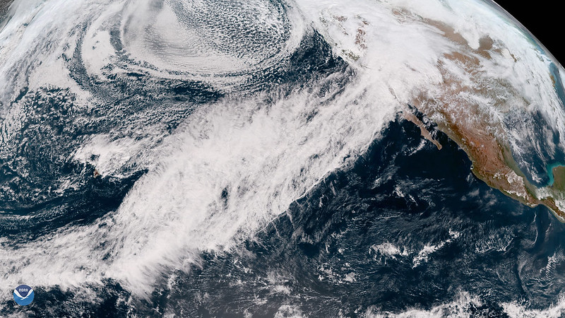

In March 2023, Southern California experienced heavy storms after almost 20 years of drought. Sixteen of these came from long, narrow regions of concentrated water vapor moving through the air, known as atmospheric rivers. During droughts, groundwater supplies up to 60% of the total water to the Greater Los Angeles area, so researchers think that stormwater from the 2023 events could have recharged groundwater reserves for future use. However, scientists lack adequate tools to assess how much groundwater is in the subsurface.
To overcome this challenge, researchers from California and Texas developed a new method to study deep groundwater. California gets a large number of earthquakes, so it has over 450 stations around the state to monitor the associated vibrations, referred to as seismic waves. To study how much the 2023 storm recharged the groundwater in the Greater Los Angeles area, the team used a tool called seismic-DI, which employs these seismic waves to estimate how much groundwater is stored at different depths.
Seismic-DI works by measuring how fast seismic waves move through the Earth, known as their seismic velocity. The researchers explained that the Greater Los Angeles area is a very crowded city, so it produces an abundance of seismic waves. They measured changes in the seismic velocities of these underground waves to see where the groundwater is full of water, or saturated, versus partially full, or unsaturated. They used 20 years of these data to produce graphs that record changes in groundwater storage at different depths, known as hydrographs.
To validate the accuracy of seismic-DI, the researchers also compared their seismic hydrographs with groundwater thickness data from a NASA mission known as the Gravity Recovery and Climate Experiment, or GRACE. GRACE consists of 2 satellites that measure changes in Earth’s gravity, which reflect surface water and groundwater storage. Both their seismic hydrographs and the GRACE groundwater data demonstrated that the Greater Los Angeles region experienced an increase in groundwater storage from stormwater in the winter, and a reduction in groundwater storage during the dry summer.
The team’s hydrographs showed that the 2023 storms saturated the Greater Los Angeles area groundwater down to 35 meters (114 feet), but it was abnormally dry at 200 meters (656 feet), and at a severe drought at 450 meters (1,476 feet). The GRACE data similarly demonstrated that the subsurface is in severe drought. Combined, these data indicated the 2023 storms helped the Greater Los Angeles area recover up to 90% of its groundwater at depths of 50 meters (164 feet) since the 2006-2022 drought. However, it recovered only about 40% at 75 meters (246 feet) and 20% to 30% at 100 meters (328 feet).
They concluded that the 2023 atmospheric river events recharged only shallow groundwater reserves in the Los Angeles area. As a result, they suggested future researchers consider deep groundwater reserves for a more complete assessment of total regional water deficits. While this study demonstrated that seismic-DI can successfully reveal spatial changes in groundwater and drought at depth, the team acknowledged that contributing factors like the amount, rate, and spatial variability of groundwater reserves remain targets of future work.
